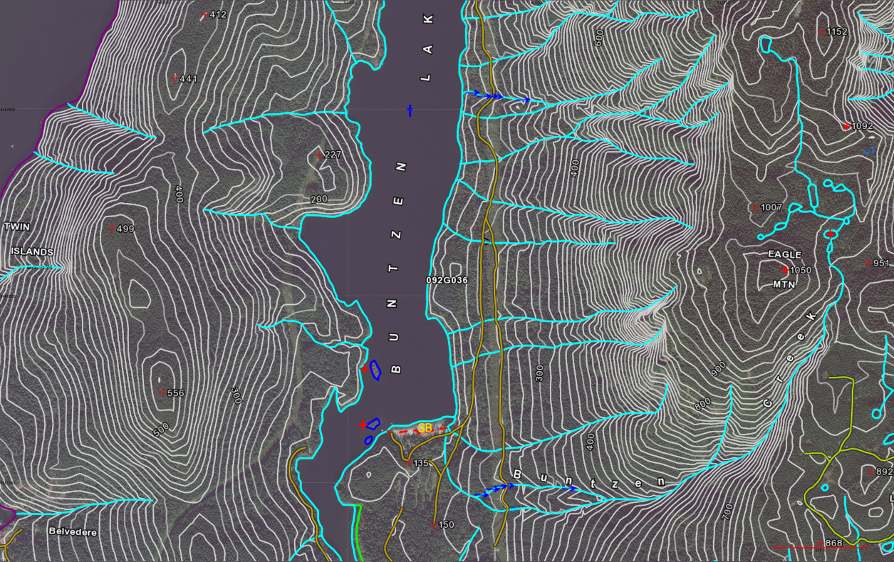
TrueNorth lets you combine data from different sources.
Shown here, aerial data from a tile map server (TMS) overlaid with high quality topographic data from the British Columbia government’s open data initiative GeoBC WMS server, showing the province’s 1:20,000 TRIM dataset.