Skip to content
TrueNorth Geospatial
Features
Requirements
Layers
Layers. GIS Software has them, most mapping software doesn’t. A simple feature, and one that is at the core of a Geographic Information System’s power. In fact, most people probably aren’t even aware that this feature exists. Consider a paper map. If you want to draw on the map you have no choice but to mark it up with indelible ink. A GIS layer is like a sheet of mylar plastic. You can draw on the mylar sheet, and it is aligned to the underlying map. Your drawing placed data on the map. If you need to add another sheet, you can draw data from a different point of view. Each mylar sheet represents some new group of information. It could be a different day, a different trip, or something else. When you no longer need it you can just remove the sheet. In a GIS, each map feature type will often be on it’s own layer. Examples are things such as roads, creeks and rivers, land cover, contours, etc — each represents data with different aspects. Roads can have a type (large, medium or small). Creeks can have a flow rate. Contours have an elevation. The data associated with…
Data Neutral
Many companies that sell general purpose mapping software are really in the business of selling you maps. They take data, often freely available, compose it into a map, and use that to sell you their software. Sometimes the maps are in special formats that are unusable in other software. Often these companies try to tie you to a subscription model, promising you yearly updates. This may work for some people — the task of finding and compiling your own maps can be daunting. TrueNorth takes a different approach. We give you the tools to read and write as many data formats as possible, and you’re free to use whatever data you come across. Now, we’re not crazy. Nobody wants to start up some mapping software and be presented with a blank screen (although you can do that if you like). We do provide base map data for areas that we can find and compile the data for free, or low costs. We’re also in the process of building a community of like-minded individuals who want to share where to find this data, and how to use it. In the mean time, we’ve built TrueNorth to support many of the most…
File Formats
Web Formats
Databases
User Interface
TrueNorth is committed to providing GIS-like power with the ease-of-use of a word processor. It’s not going to be easy, but we’ve made some great progress. Here’s some of the UI features we’ve built to make this possible Dockable Windows The core of the TrueNorth UI system is the “dockable” window manager. The philosophy is this: as a developer we can’t predict how many monitors you’re going to have, how many maps you’ll want to have open, or what kind of plug-ins you’re going to be running. In order to support these unpredictable needs, we decided to enable the software to open as many views onto as many maps as you want, and to move them onto any screen. The windows can be “docked,” or snapped together in different formats as required. The software will remember the layout, and attempt to re-created it the next time you run it. This means if you want to look at your data overlaid on an OpenStreetMap base map in one window, while videing the same data on a contour map, you can do it. Ribbon Toolbar The “Ribbon” toolbar is what user interface developers call the approach Microsoft used in their Microsoft Office…
GPS & Devices
For most modern map users, there’s no point having the mapping software if you don’t have a GPS. TrueNorth Geospatial works natively with most Garmin® GPS units. You can upload and download data. For other GPS units, compatibility is provided through support of the GPX file format.
Blog
Articles
Development
Screenshots
Tag:
UI
17/04/2012
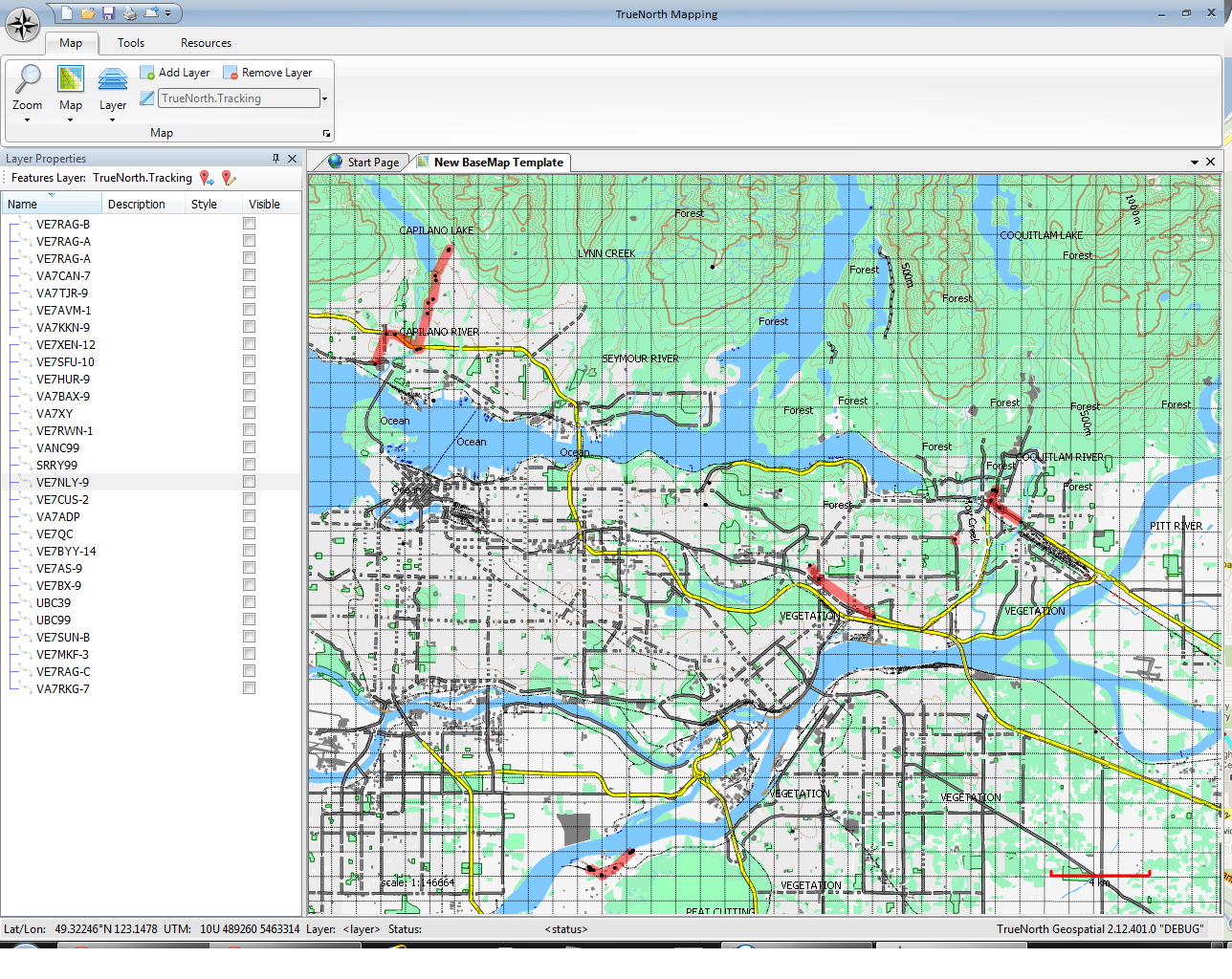
Alpha Screenshot: Tracking layer
30/03/2012
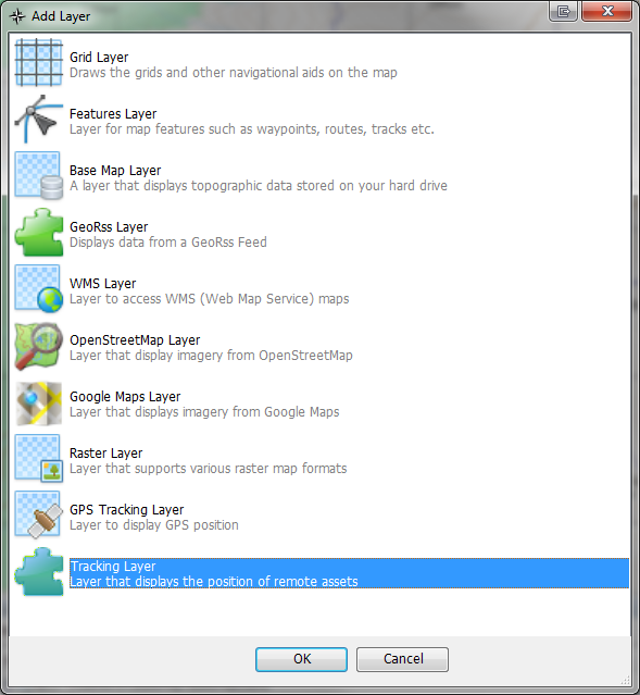
Alpha Screenshot: Add Layer Dialog
21/02/2012
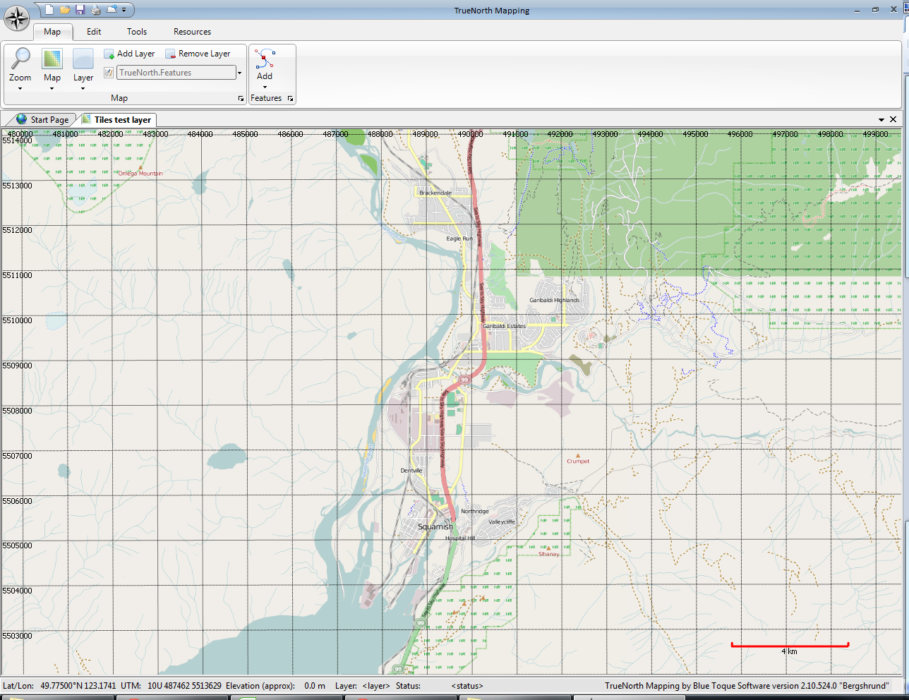
Alpha Screenshot: OpenStreetMap
04/01/2012
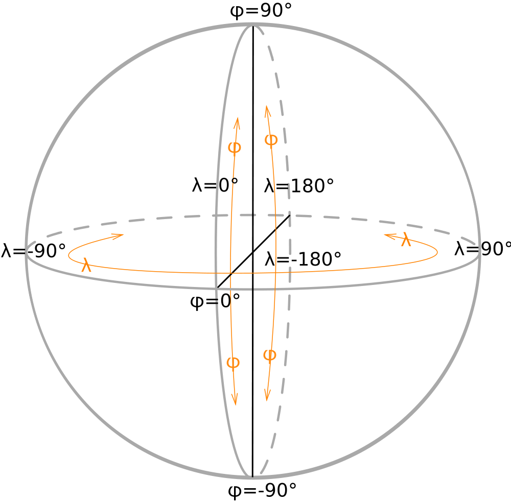
Coordinate Systems
Search for an article
Search
Search