Updates
-
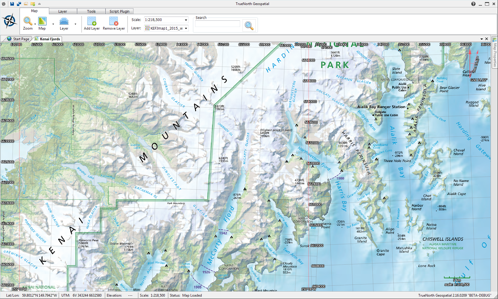
Case Study: Paddling in Kenai Fjords National Park
Nick got invited to a last minute paddling trip to Kenai Fjords National Park in Alaska. As a responsible adventurer, he wanted to have a good map to take with him that included information about the park, where to camp, landmarks, and place names. He also wanted to take it on his Garmin GPSMap 62ST – a very capable, waterproof
-
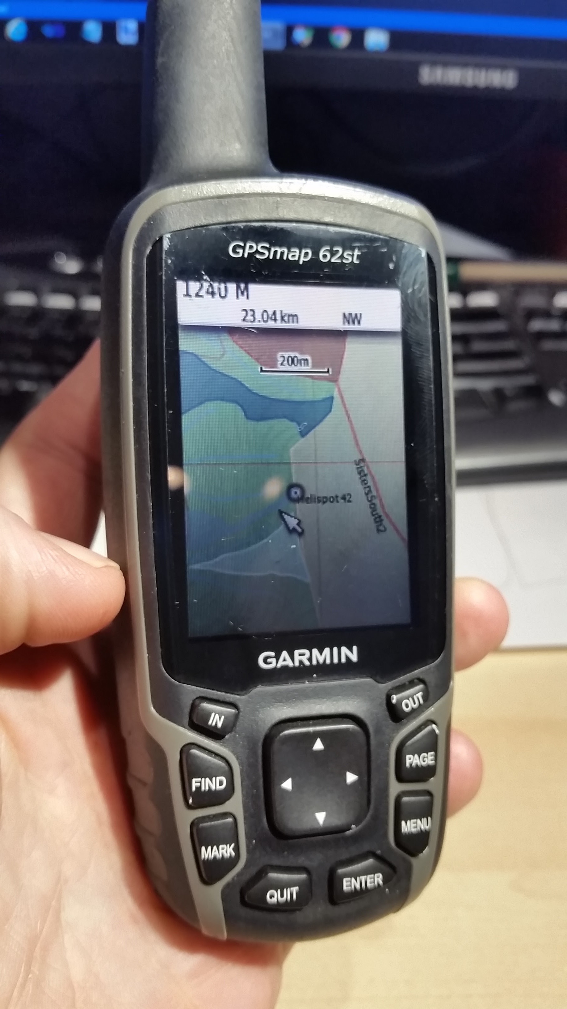
Garmin GPS Maps support
TrueNorth Geospatial now supports downloading maps to certain Garmin GPS units. Map data loaded and displayed in TrueNorth including raster, vector, tiles, and GeoPDFs can be exported as a KML Overlay in a KMZ file and downloaded to GPS units that support this feature. There is no configuration necessary and TrueNorth automates the generation of the images and georeferencing
-
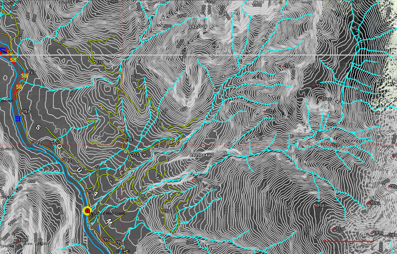
Disaster Mapping: Mud Creek Washout
A washout on a creek that regularly delivers torrents of mud and debris. So often the name of the creek is Mud Creek. The washout traps hundreds of campers and outdoor recreationists in a very popular backcountry area. SAR team and public safety members respond. The Ministry of Forests posts KML of the location, but on
-
TrueNorth Beta Release
We’re very happy to announce TrueNorth is officially in open beta. Several months ago we contacted a list of people who were interested in testing TrueNorth in what we called the “closed beta”. In this phase, selected users were invited to download and test TrueNorth. Given that the software is under development, we are very grateful to those
-
SARScene 2013
TrueNorth Geospatial is being demoed at SARScene this year. We have a booth at the trade show, so come by and see the software in action and give us some feedback on features you would like to see supported. Additionally, TrueNorth author Michael Coyle will be presenting at several sessions, talking about UAVs and SAR,
-
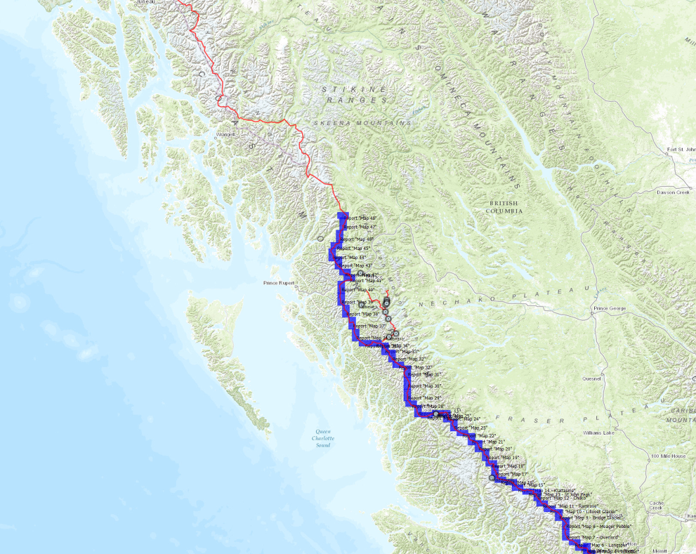
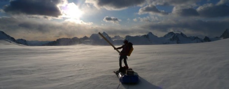
Planning an 1800 km backcountry trip
How do you plan an 1800 km backcountry ski trip? We have no idea. The longest backcountry ski trip the TrueNorth team has done is eleven days. However, what we do know is that any backcountry trip, of any length, needs a map. In this case, more than 100!. When we heard about the Traverse
-
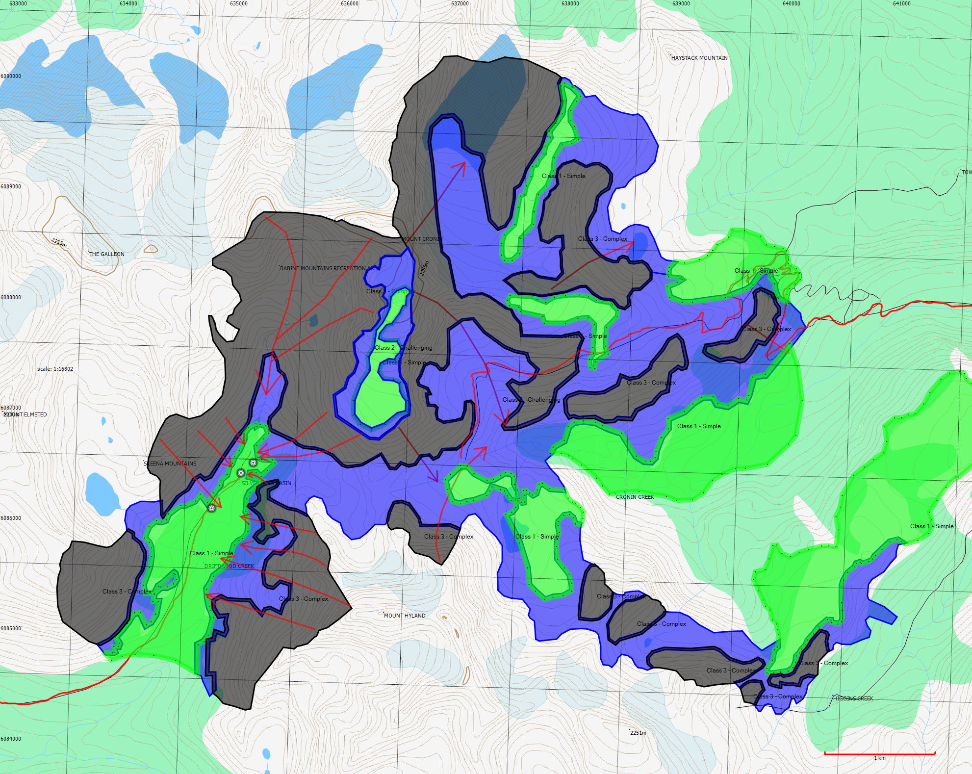
Avalanche Terrain Analysis
A few months back the Canadian Avalanche Association sent around a set of KML files showing avalanche terrain analysis of some popular backcountry ski and snowmobile areas in British Columbia. These files rate the terrain according to the Avalanche Terrain Exposure Scale (ATES) in terms of simple, challenging or complex – terms intended to indicate
-
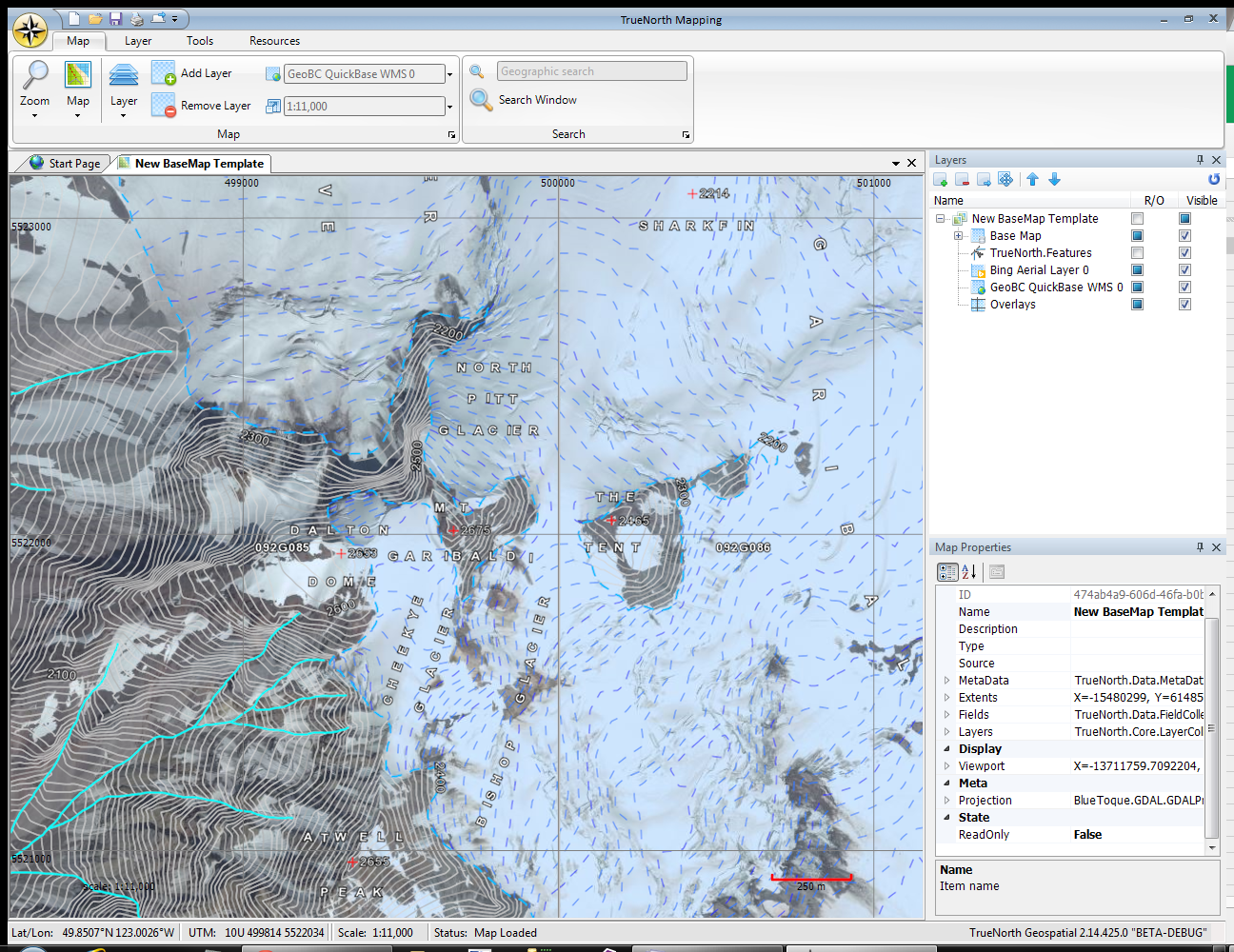
Updated Map Data and Rendering
We updated our dataset for the topographic map of Canada to the latest version, and processed it all into TrueNorth format over the course of an 18 hour long run. This served the dual purposes of getting the new data into the program, while at the same time stress testing TrueNorth as it loaded and
-
Traverse the Coast
As we posted last week, TrueNorth is in very active field trials, having been used on three recent Search and Rescue tasks. We’re also happy to announce that we’re expanding the field trial to include producing expedition maps for a team of backcountry adventurers who are attempting to do a ski and packraft traverse of the Coast
-
Reading Garmin IMG Maps
One of the main principles we built TrueNorth around was this; we want you to be able to use it with the maps you already own. We’re not the in the business of making and selling maps. We make a tool that lets you read map data from almost anywhere, including maps you may already